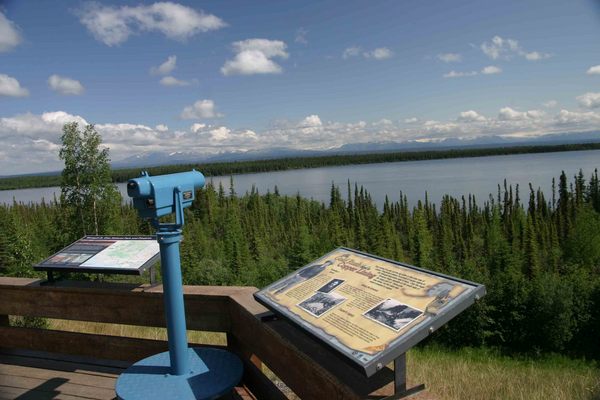
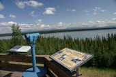
The first major road built in Alaska, the 360-mile long Richardson Highway runs as Alaska Route 4 from Valdez to Delta Junction and as Alaska Route 2 from there to Fairbanks.
In 1898, to provide an "all-American" route to the Klondike gold fields, the US Army constructed a 409-mile pack trail from the port of Old Valdez (which lay about 4 miles east of present-day Valdez prior to being destroyed in the 1964 Good Friday Earthquake) to Eagle near the Yukon border. After the rush ended, the Army kept the trail open in order to connect its posts near the two towns.
The 1902 Fairbanks gold rush and the construction of a telegraph line along the trail in 1903 made the Valdez-to-Eagle route one of the most important access routes to the interior, so the Alaska Road Commission upgraded it to a wagon road in 1910. In addition to regular construction workers, the government hired failed gold prospectors, many of whom made enough money to leave Alaska. Several roadhouses now on the National Register of Historic Places were constructed along the route at this time.
The first car traveled the route from Valdez to Eagle in 1913. An increase in motorized travel led to upgrading the road in the 1920s. To finance continued maintenance and road construction, the Alaska Road Commission instituted tolls for commercial vehicles in 1933 of up to $175 per trip, which were collected at the Tanana River ferry crossing at Big Delta. When the tolls were further increased in 1941 to boost business for the Alaska Railroad, disgruntled truckers started a ferry service in order to evade the toll.
The Alaska and Glenn highways, built during World War II, connected the rest of the continent and Anchorage to the Richardson Highway at Delta Junction and Glennallen respectively, allowing motor access to the new military bases built in the Territory just prior to the war. The bridge at Big Delta, the last remaining gap, was built as part of the Alaska Highway project.
The southern end was only open during summers until 1950, when a freight company foreman who lived near the treacherous Thompson Pass plowed the snow himself for an entire season to prove the route could be used year-round. The highway was paved in 1957.
The Trans-Alaska Pipeline System, built in 1973 to 1977, mostly parallels the highway from Fairbanks to Valdez.